Non-native tree removal, tree & wildflower planting map
To view an interactive map of the our non-native trees removal (NNR), and the trees and wildflowers planted since the project started, you can use the link here or click the screenshot of the map. You will then be able to click on the polygons to see when the areas were cleared or planted, what techniques were used, and numbers of trees of which species were planted. For areas with both NNR and planting, use the arrows in the top left of the pop-up to scroll through.
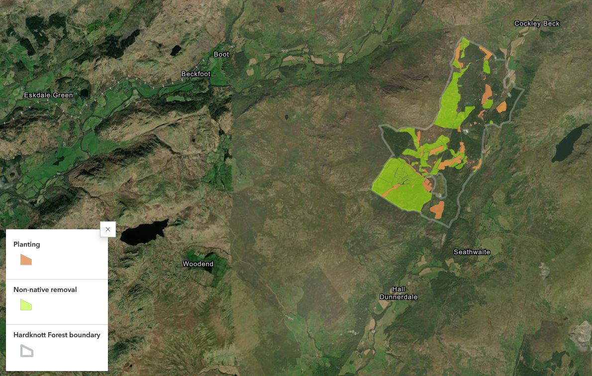
Map created by Jess Wilson, RHF Site Officer.