Phase 1 Habitat Survey
In summer 2020, we completed a Phase 1 Habitat Assessment at Hardknott, looking at the diversity and distribution of habitats across the site. Using a combination of aerial photographs and on-site surveying, each area of distinct habitat greater than 0.1 hectares was categorized, according to classifications set by the JNCC. We adapted the traditional methodology slightly to give a greater level of detail around the composition of woodland habitats (native vs non-native species), the height of the tree canopy and the density of tree cover. In total, 64 different habitat types were identified.

Proportions of woodland cover types at Hardknott Forest
The results of the survey show that the most common habitat at Hardknott is semi-improved acid grassland, found around the most recently felled areas to the south-west of the site, as well as around the settlements at Grassguards, the Birks and Hinning House. Encouragingly, the second most common habitat is broadleaf woodland , closely followed by mixed woodland containing 50-90% broadleaf trees, between them covering 30% of Hardknott. However, the majority of these broadleaf habitats have estimated canopy heights of less than 5m, showing that the trees are still establishing. 91 hectares (around 14%) of the site is still covered by same-age stands of coniferous plantation. Collectively, just under two thirds of the site is covered by woodland of some kind. Other key habitats within our site mosaic include both wet and dry dwarf shrub heath, and blanket bog.
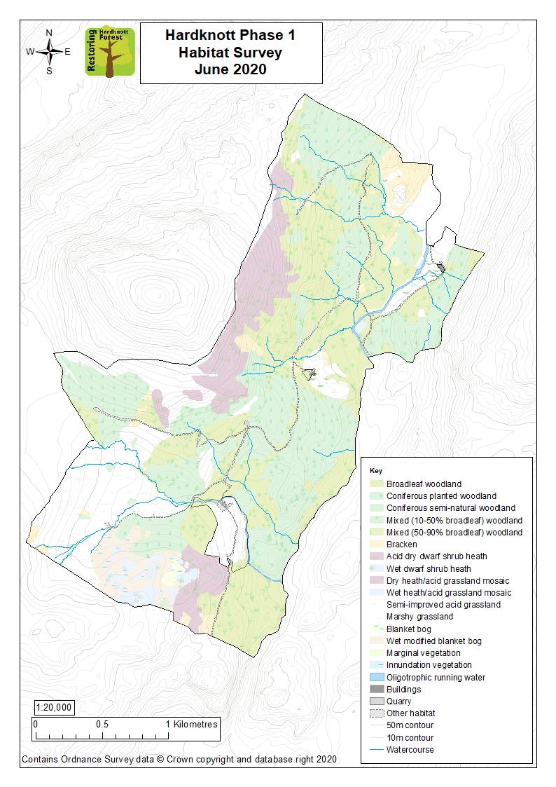
Overview map: all habitat types
The survey will be a useful tool for interpreting wildlife surveys, such as our recent breeding bird survey, as well as aiding management of the site and providing a benchmark for monitoring future habitat change.
The full report is available below.